This Map is an Award Winner
I think that the last contest I won was junior high school science fair. Not sure. I don't enter a lot of contests.
A couple weeks ago I came across an on-line map-making contest sponsored by ProFantasy.com, makers of great cartography software for role-playing games. Make an island, they said, about three miles across. Something like a medieval treasure map. The contest had been open for months, but was closing in just a few days. I took a look at the submissions that had been sent in thus far, decided I had a shot at winning, and threw myself into it.
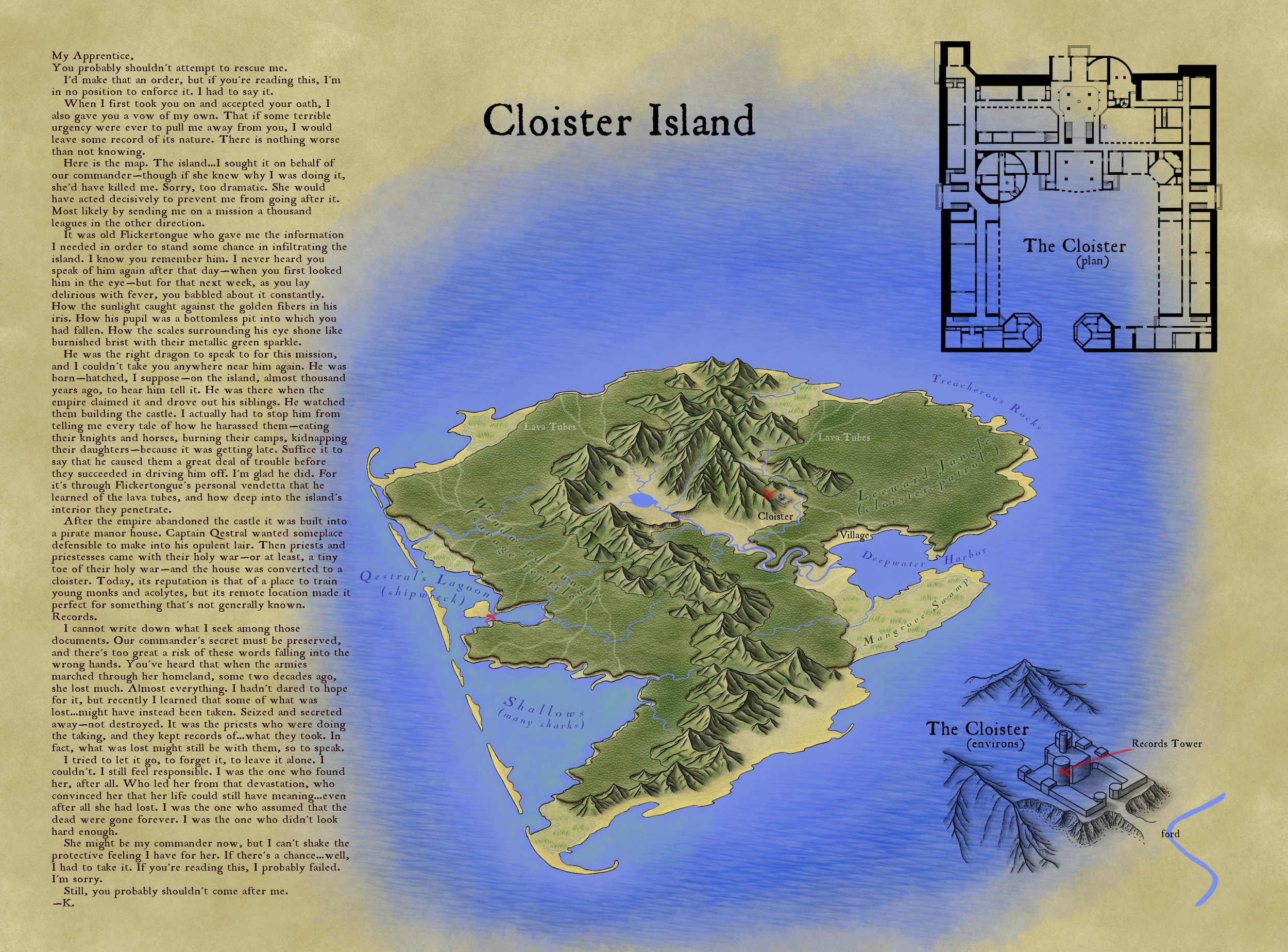
Victory! As judged by Mike Schley (something of a legend in the fantasy cartography world, and someone whose maps I've been admiring for years) my map took the prize.
I worked feverishly, right up to the deadline, and actually ran out of time to put everything I wanted into the map. That's why there's no border around it, and no compass rose... But what I did manage to produce followed my vision. I wanted to have some storytelling elements that would blend with the drawing. Some secrets or clues that would only be available to those who looked closely. And an overall aesthetic that was vivid and eye-catching.
Of all the submissions, I felt that the Cloister Island map functioned best as both a visual information system and an inspiring illustration of its setting. Even though the cartographer left off a compass rose and scale bar, the overall work felt the most coherent and provided numerous levels of information. Like an onion, the island and story revealed themselves in layers, giving the reader an opportunity to explore deeper and deeper into an immersive world. On top of this, I’m a sucker for hand drawn isometric maps. --Mike Schley
If you're interested in my process, here is what I wrote when I posted the map to the forum:
I haven't yet been paid for my skills in this arena, so I'd have to consider myself an amateur.
Virtually all of this map was hand-drawn in ProCreate on an iPad 3 using an Adonit Touch stylus. There are a few "pattern brushes" in that app which help with things like the the jungle trees and the ocean waves, but everything else is just drawn. The shape of the island and mountains isn't based on anything other than doodling with the idea of a vaguely volcanic tropical island in mind.
The cloister overhead plan was laid out in Adobe Illustrator. It's far larger, sharper, and more detailed in the original file, with many upper floors and basement dungeon levels. The "3D" isometric extrusion of the cloister is actually just faux-3D, a technique I use in Illustrator where I take the overhead plan and rotate, squash, duplicate and move by a certain amount, and then blend. I took a screen shot of that and traced over it in ProCreate.
The last step was to bring it all into Adobe Photoshop, create a "parchment background", lay out the various pieces, and add in the text elements. Then I did save-for-web and picked settings that looked good but kept the resulting file under 2 MB.
The cloister itself is about 300 feet on one axis, making the hypotenuse around 500 feet. Since you can line up 30 of the little cloister images end to end and have them stretch from one side of the island to the other, the island winds up being about 3 miles across.

